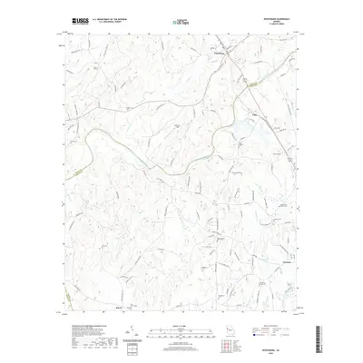
2020 Map of Whitesburg
USGS Topo · Published 2020About this map
Whitesburg sits at the northern end of this geographic study, where the Chattahoochee River carves a winding path through the borderlands of Carroll, Coweta, and Heard Counties. The landscape is defined by the river’s extensive drainage system, including Acorn Cr, Wahoo Cr, and Turkey Cr, which fragment the terrain into a series of ridges and hollows. These natural barriers are overcome by a network of local routes like Old Boy Scout Rd and Mount Carmel Rd, connecting small rural settlements and agricultural clearings such as McIntosh Field.
Find a feature on this map
113 named features on this map. Tap any name to fly to it.
Don’t see what you’re looking for? This feature index may not catch every label — zoom into the map to look around manually.
Map Details
Editions of this 2020 Whitesburg Map
This is the sole edition of this map. No revisions or reprints were ever made.
Other maps of this area

1889 · Tallapoosa
USGS Topo · 1:125,000

1891 · Marietta
USGS Topo · 1:125,000

1892 · Tallapoosa
USGS Topo · 1:125,000

1895 · Marietta
USGS Topo · 1:125,000

1897 · Marietta
USGS Topo · 1:125,000

1897 · Tallapoosa
USGS Topo · 1:125,000

1899 · Wedowee
USGS Topo · 1:125,000

1901 · Marietta
USGS Topo · 1:125,000

1902 · Wedowee
USGS Topo · 1:125,000

1953 · Atlanta
USGS Topo · 1:250,000