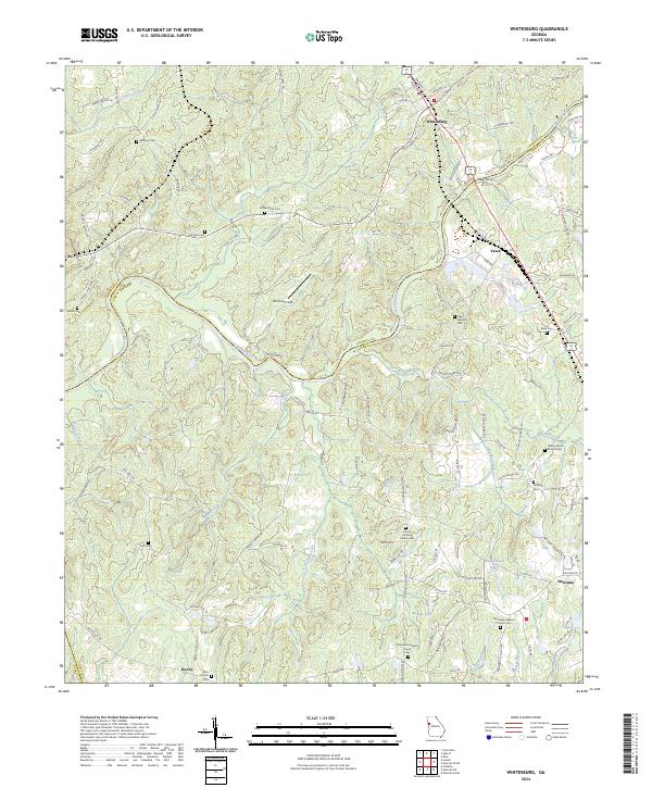
2024 Map of Whitesburg
USGS Topo · Published 2024About this map
The Chattahoochee River forms a significant natural boundary through this landscape, separating Carroll and Coweta counties. The town of Whitesburg sits at a historic crossroads in the north, served by the Norfolk Southern rail line. This corridor reflects a deep-rooted rural settlement pattern, where small communities like Handy, Yates, and Welcome are anchored by numerous family and church burial grounds. Notable sites include Ephesus Cem, New Lebanon Cem, and the Providence Baptist Church Cem.
Find a feature on this map
123 named features on this map. Tap any name to fly to it.
Don’t see what you’re looking for? This feature index may not catch every label — zoom into the map to look around manually.
Map Details
Editions of this 2024 Whitesburg Map
This is the sole edition of this map. No revisions or reprints were ever made.
Other maps of this area

1889 · Tallapoosa
USGS Topo · 1:125,000

1891 · Marietta
USGS Topo · 1:125,000

1892 · Tallapoosa
USGS Topo · 1:125,000

1895 · Marietta
USGS Topo · 1:125,000

1897 · Marietta
USGS Topo · 1:125,000

1897 · Tallapoosa
USGS Topo · 1:125,000

1899 · Wedowee
USGS Topo · 1:125,000

1901 · Marietta
USGS Topo · 1:125,000

1902 · Wedowee
USGS Topo · 1:125,000

1953 · Atlanta
USGS Topo · 1:250,000