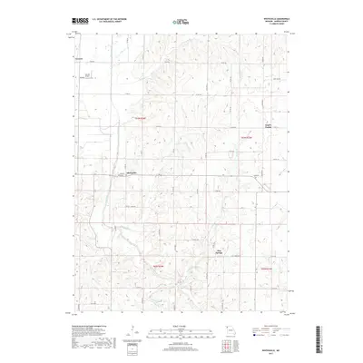
2017 Map of Whitesville
USGS Topo · Published 2017About this map
Whitesville serves as a focal point for this rural Missouri landscape, situated where Main St and Union St intersect in Andrew County. The map reveals a land defined by its winding waterways, including the southward flow of the Platte River and its various tributaries such as Hickory Cr and Clear Cr. The settlement pattern is characterized by small, dispersed communities and the rectangular grid of the Public Land Survey System, with township boundaries like t61n r34w clearly delineated.
Find a feature on this map
60 named features on this map. Tap any name to fly to it.
Don’t see what you’re looking for? This feature index may not catch every label — zoom into the map to look around manually.
Map Details
Editions of this 2017 Whitesville Map
This is the sole edition of this map. No revisions or reprints were ever made.
Other maps of this area

1923 · Clarksdale
USGS Topo · 1:62,500

1924 · St. Joseph
USGS Topo · 1:62,500

1925 · Clarksdale
USGS Topo · 1:62,500

1925 · Stanberry
USGS Topo · 1:62,500

1926 · Saint Joseph
USGS Topo · 1:62,500

1927 · Bolckow
USGS Topo · 1:62,500

1939 · Stanberry
USGS Topo · 1:62,500

1943 · Stanberry
USGS Topo · 1:62,500

1945 · Bolckow
USGS Topo · 1:62,500

1950 · Kansas City
USGS Topo · 1:250,000