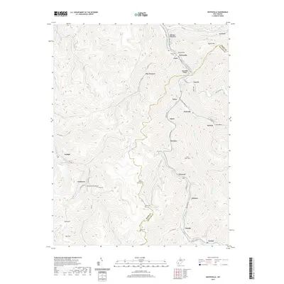
2019 Map of Whitesville
USGS Topo · Published 2019About this map
The Coal River and its major forks define the settlement patterns of this West Virginia coalfield region, where steep ridges separate long-established mining and rail communities. Whitesville serves as a primary hub near the confluence of Elk Run and the Marsh Fork, with residential and industrial activity concentrated along the narrow valley floors. The landscape is marked by numerous family and community burial grounds, including Mordue Cem, Jarrells Cem, and Asbury Cem, which are tucked away in the hollows. Moving south and east, the map traces the winding paths of Marsh Fork through Birchton, Montcoal, and Stickney. This survey illustrates the dense network of local routes like Sackville Rd and Packsville Marfork Rd that connect high mountain gaps and secluded settlements like Blue Pennant and Twilight in a topography dominated by Cherry Pond Mtn and Kayford Mtn.
Find a feature on this map
68 named features on this map. Tap any name to fly to it.
Don’t see what you’re looking for? This feature index may not catch every label — zoom into the map to look around manually.
Map Details
Editions of this 2019 Whitesville Map
This is the sole edition of this map. No revisions or reprints were ever made.
Other maps of this area

1891 · Oceana
USGS Topo · 1:125,000

1891 · Raleigh
USGS Topo · 1:125,000

1893 · Oceana
USGS Topo · 1:125,000

1897 · Kanawha Falls
USGS Topo · 1:125,000

1897 · Raleigh
USGS Topo · 1:125,000

1898 · Oceana
USGS Topo · 1:125,000

1899 · Charleston
USGS Topo · 1:125,000

1900 · Kanawha Falls
USGS Topo · 1:125,000

1901 · Kanawha Falls
USGS Topo · 1:125,000

1902 · Raleigh
USGS Topo · 1:125,000