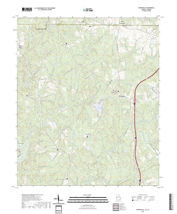
2024 Map of Whitesville
USGS Topo · Published 2024About this map
The community of Whitesville sits at the heart of this landscape, positioned along Whitesville Rd where the rural geography transitions between the Troup and Harris county lines. This area is characterized by a high density of family and congregational burial grounds, such as the Whitesville Methodist Episcopal Church South Cem, Billingslea Cem, and Hutchinson Cem, which serve as significant markers for genealogists tracing local lineage.
Find a feature on this map
55 named features on this map. Tap any name to fly to it.
Don’t see what you’re looking for? This feature index may not catch every label — zoom into the map to look around manually.
Map Details
Editions of this 2024 Whitesville Map
This is the sole edition of this map. No revisions or reprints were ever made.
Other maps of this area

1907 · Talbotton
USGS Topo · 1:125,000

1907 · Opelika
USGS Topo · 1:125,000

1909 · Opelika
USGS Topo · 1:125,000

1950 · Mulberry Grove
USGS Topo · 1:24,000

1950 · Ellerslie
USGS Topo · 1:62,500
1955 · Mulberry Grove
USGS Topo · 1:24,000
1955 · Ellerslie
USGS Topo · 1:62,500

1955 · Phenix City
USGS Topo · 1:250,000

1957 · Phenix City
USGS Topo · 1:250,000

1958 · Phenix City
USGS Topo · 1:250,000