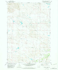
1982 Map of Whitetail Creek
USGS Topo · Published 1982About this map
Whitetail Creek and its many seasonal tributaries define this corner of Carter County, Montana, as mapped during the mid-1970s and edited for this 1982 release. The landscape is a complex network of drainages and draws, where the Middle Fork Muskrat Creek and South Fork Muskrat Creek converge to form the primary Muskrat Creek waterway. These intermittent streams are critical markers for land ownership and cattle grazing in the high plains.
Find a feature on this map
13 named features on this map. Tap any name to fly to it.
Don’t see what you’re looking for? This feature index may not catch every label — zoom into the map to look around manually.
Map Details
Editions of this 1982 Whitetail Creek Map
This is the sole edition of this map. No revisions or reprints were ever made.
Other maps of this area

1954 · Ekalaka
USGS Topo · 1:250,000

1956 · Ekalaka
USGS Topo · 1:250,000

1958 · Ekalaka
USGS Topo · 1:250,000

1965 · Ekalaka
USGS Topo · 1:250,000

1979 · W L Butte
USGS Topo · 1:24,000

1979 · Dutchman Creek
USGS Topo · 1:24,000

1979 · Ikey Creek
USGS Topo · 1:24,000

1981 · Alzada
USGS Topo · 1:100,000

1982 · Phillippi Reservoir
USGS Topo · 1:24,000
1982 · Potato Buttes
USGS Topo · 1:24,000