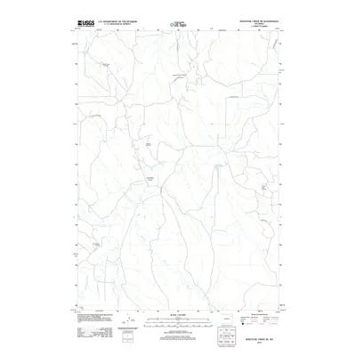
2012 Map of Whitetail Creek NE
USGS Topo · Published 2012About this map
The Belle Fourche River winds through this section of Campbell County, carving a path across a landscape defined by industrial energy extraction and ranching access. In the early 21st century, the region's economy is clearly etched onto the terrain through a network of specialized production areas, including the Duvall Ranch Oil Field and the Slattery Oil Field. This survey shows how local infrastructure like Sunny Slope Rd and Donkey Creek Rd provides the necessary links between active wells and the wider Wyoming plains.
Find a feature on this map
21 named features on this map. Tap any name to fly to it.
Don’t see what you’re looking for? This feature index may not catch every label — zoom into the map to look around manually.
Map Details
Editions of this 2012 Whitetail Creek NE Map
This is the sole edition of this map. No revisions or reprints were ever made.
Other maps of this area

1918 · Moorcroft
USGS Topo · 1:125,000

1918 · Moorcroft
USGS Topo · 1:62,500

1954 · Gillette
USGS Topo · 1:250,000

1955 · Gillette
USGS Topo · 1:250,000

1957 · Moorcroft
USGS Topo · 1:62,500

1958 · Gillette
USGS Topo · 1:250,000

1962 · Gillette
USGS Topo · 1:250,000

1971 · Coon Track Creek
USGS Topo · 1:24,000

1971 · Whitetail Creek
USGS Topo · 1:24,000
1971 · Whitetail Creek SE
USGS Topo · 1:24,000