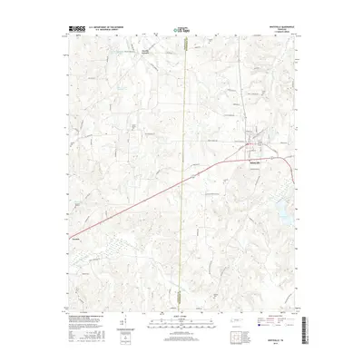
2016 Map of Whiteville
USGS Topo · Published 2016About this map
Whiteville serves as the central hub of this West Tennessee landscape, where the town street grid intersects with several regional travel routes near the Fayette Co and Hardeman Co boundary. The area's agricultural and civil history is visible through numerous burial grounds such as Mount Moriah Cem, Farley Cem, and Pleasant Hill Cem, many of which sit along rural roads like Old Jackson Rd and Old Whiteville Rd. The drainage patterns of the region are heavily modified, as seen in the engineered paths of the Big Muddy Canal and the Loosahatchie River Canal, which manage water flow through the low-lying terrain. To the north, Fayette Corners and the waters of Bear Cr Watershed Lake Number One and Bear Cr Lake Number Two mark a transition into more secluded territory, while Whiteville Lake provides a significant water feature just southeast of the town center.
Find a feature on this map
66 named features on this map. Tap any name to fly to it.
Don’t see what you’re looking for? This feature index may not catch every label — zoom into the map to look around manually.
Map Details
Editions of this 2016 Whiteville Map
This is the sole edition of this map. No revisions or reprints were ever made.
Other maps of this area

1949 · Moscow
USGS Topo · 1:62,500

1950 · Middleburg
USGS Topo · 1:24,000

1951 · Middleburg
USGS Topo · 1:24,000

1951 · Hickory Valley
USGS Topo · 1:24,000

1952 · Dancyville
USGS Topo · 1:24,000

1952 · Laconia
USGS Topo · 1:24,000

1952 · Stanton
USGS Topo · 1:62,500

1956 · Blytheville
USGS Topo · 1:250,000

1959 · Blytheville
USGS Topo · 1:250,000

1959 · Whiteville
USGS Topo · 1:24,000