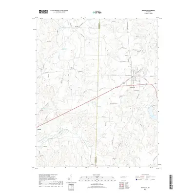
2019 Map of Whiteville
USGS Topo · Published 2019About this map
Whiteville serves as the primary hub of this landscape, situated along the border of Fayette Co and Hardeman Co. The area is characterized by its complex network of waterways and drainage projects, including the substantial Big Muddy Canal and the Loosahatchie River Canal, which channel the low-lying terrain south and west of town. To the north, the landscape is dotted with smaller water bodies such as Bear Cr Lake Number Two and Bear Cr Watershed Lake Number One.
Find a feature on this map
73 named features on this map. Tap any name to fly to it.
Don’t see what you’re looking for? This feature index may not catch every label — zoom into the map to look around manually.
Map Details
Editions of this 2019 Whiteville Map
This is the sole edition of this map. No revisions or reprints were ever made.
Other maps of this area

1949 · Moscow
USGS Topo · 1:62,500

1950 · Middleburg
USGS Topo · 1:24,000

1951 · Middleburg
USGS Topo · 1:24,000

1951 · Hickory Valley
USGS Topo · 1:24,000

1952 · Dancyville
USGS Topo · 1:24,000

1952 · Laconia
USGS Topo · 1:24,000

1952 · Stanton
USGS Topo · 1:62,500

1956 · Blytheville
USGS Topo · 1:250,000

1959 · Blytheville
USGS Topo · 1:250,000

1959 · Whiteville
USGS Topo · 1:24,000