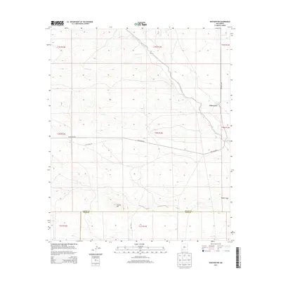
2013 Map of Whitewater
USGS Topo · Published 2013About this map
Whitewater stands at a pivotal junction of the high desert landscape, where the seasonal waters of San Vicente Arroyo and Cherry Cr converge. This 2013 survey documents a terrain defined by intermittent drainages and significant relief, most notably at Hogback Mtn and the adjacent Hogback Draw. The map illustrates the sparsely settled character of this portion of New Mexico, where the infrastructure of White Water Rd and Co Road D002 provides the primary access through the wide alluvial plains and rocky outcrops. The boundary between Grant Co and Luna Co is clearly delineated in the southern portion of the sheet, marking a transition in local jurisdiction across the scrub-dotted flats. Researchers will find a precise record of the hydrologic network, including Cameron Cr and Oak Grove Cr, which dictate the placement of ranching roads and remote homestead sites.
Find a feature on this map
18 named features on this map. Tap any name to fly to it.
Don’t see what you’re looking for? This feature index may not catch every label — zoom into the map to look around manually.
Map Details
Editions of this 2013 Whitewater Map
This is the sole edition of this map. No revisions or reprints were ever made.
Other maps of this area

1909 · Silver City
USGS Topo · 1:125,000

1947 · Faywood Station
USGS Topo · 1:24,000

1948 · Hurley East
USGS Topo · 1:24,000

1949 · Whitewater
USGS Topo · 1:24,000

1949 · Hurley East
USGS Topo · 1:24,000

1949 · Faywood Station
USGS Topo · 1:24,000

1949 · Hurley West
USGS Topo · 1:24,000

1950 · Tyrone
USGS Topo · 1:24,000

1950 · White Signal
USGS Topo · 1:24,000

1951 · White Signal
USGS Topo · 1:24,000