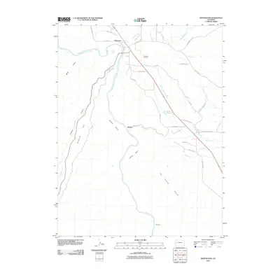
2010 Map of Whitewater
USGS Topo · Published 2010About this map
The Gunnison River winds through this landscape south of Grand Junction, defining a corridor where human irrigation engineering meets deep desert topography. At the settlement of Whitewater, the modern road network branches out into the high country, while the Kannah Creek Extension Ditch and Smith Ditch trace the contours of the land, illustrating the critical role of water management in Mesa County. Local history is anchored by the Whitewater Cemetery and the small communities of Kannah and Deer Run. The map provides a detailed view of the transition from the river valley to prominent landforms such as Ninemile Hill, Milbern Bench, and the expansive The Hunting Ground. To the west, the steep descents into Bangs Canyon and Unaweep Canyon mark the edge of the rugged plateau, while the Desert Reservoir serves as a vital upland water source in this arid environment.
Find a feature on this map
36 named features on this map. Tap any name to fly to it.
Don’t see what you’re looking for? This feature index may not catch every label — zoom into the map to look around manually.
Map Details
Editions of this 2010 Whitewater Map
This is the sole edition of this map. No revisions or reprints were ever made.
Other maps of this area

1956 · Moab
USGS Topo · 1:250,000

1956 · Grand Junction
USGS Topo · 1:250,000

1959 · Grand Junction
USGS Topo · 1:250,000

1959 · Moab
USGS Topo · 1:250,000

1960 · Moab
USGS Topo · 1:250,000

1960 · Grand Junction
USGS Topo · 1:250,000

1962 · Moab
USGS Topo · 1:250,000

1962 · Grand Junction
USGS Topo · 1:250,000

1962 · Clifton
USGS Topo · 1:24,000

1962 · Grand Junction
USGS Topo · 1:24,000