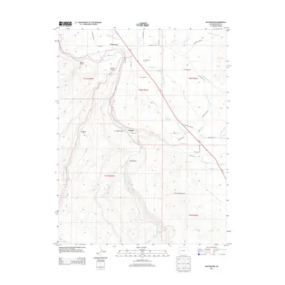
2013 Map of Whitewater
USGS Topo · Published 2013About this map
The Gunnison River carves through this Mesa County landscape, where the settlement of Whitewater sits at the northern edge near the mouth of Unaweep Canyon. This 2013 survey illustrates a high-desert environment defined by complex water management and rugged topography, from the heights of Ninemile Hill to the flat expanse of Milbern Bench. A network of irrigation features, including the Kannah Cr Extension Ditch and Shropshire Ditch, supports the local geography around the small community of Kannah. Genealogists may find interest in the Whitewater Cem located off Desert Rd. The southern portion of the map transitions into more isolated territory, featuring Hallock Basin and the aptly named The Hunting Ground, illustrating how land use is dictated by the dramatic shifts in elevation and proximity to the river.
Find a feature on this map
45 named features on this map. Tap any name to fly to it.
Don’t see what you’re looking for? This feature index may not catch every label — zoom into the map to look around manually.
Map Details
Editions of this 2013 Whitewater Map
This is the sole edition of this map. No revisions or reprints were ever made.
Other maps of this area

1956 · Moab
USGS Topo · 1:250,000

1956 · Grand Junction
USGS Topo · 1:250,000

1959 · Grand Junction
USGS Topo · 1:250,000

1959 · Moab
USGS Topo · 1:250,000

1960 · Moab
USGS Topo · 1:250,000

1960 · Grand Junction
USGS Topo · 1:250,000

1962 · Moab
USGS Topo · 1:250,000

1962 · Grand Junction
USGS Topo · 1:250,000

1962 · Clifton
USGS Topo · 1:24,000

1962 · Grand Junction
USGS Topo · 1:24,000