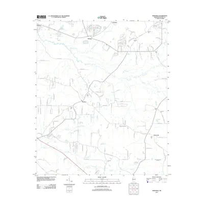
2012 Map of Whitfield
USGS Topo · Published 2012About this map
Whitfield and Monterey anchor this central Mississippi landscape where the sprawling residential street networks of Greenfield meet the older rural traditions of Rankin County. The area is defined by a dense concentration of community burial grounds, including Sandhill Cem, Bethel Cem, and Briar Hill Cem, which serve as vital landmarks for local genealogists. In the southeastern corner, the Thomasville Oil and Gas Field indicates the subsurface industrial activity that has long shaped the regional economy near Thomasville. The drainage patterns of Richland Cr and Steen Cr carve through the terrain, while Tullos Field Airport provides a modern aeronautical touchpoint amidst the many named country roads and cemeteries like Goodhope Cem and Jerusalem Cem.
Find a feature on this map
142 named features on this map. Tap any name to fly to it.
Don’t see what you’re looking for? This feature index may not catch every label — zoom into the map to look around manually.
Map Details
Editions of this 2012 Whitfield Map
This is the sole edition of this map. No revisions or reprints were ever made.
Other maps of this area

1903 · Jackson
USGS Topo · 1:125,000

1905 · Jackson
USGS Topo · 1:48,000

1906 · Florence
USGS Topo · 1:62,500

1908 · Jackson
USGS Topo · 1:62,500

1908 · Florence
USGS Topo · 1:62,500

1922 · Pelahatchee
USGS Topo · 1:48,000

1924 · Pelahatchee
USGS Topo · 1:62,500

1950 · Pelahatchie
USGS Topo · 1:62,500

1952 · Pelahatchie
USGS Topo · 1:62,500

1953 · Meridian
USGS Topo · 1:250,000