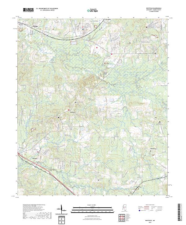
2024 Map of Whitfield
USGS Topo · Published 2024About this map
Florence and Monterey anchor this contemporary view of Rankin County, where suburban development meets the creek systems that drain toward the Pearl River. The landscape is defined by the winding paths of Richland Creek and Terrapin Skin Creek, with the Kansas City Southern railroad corridor cutting through the northern section near Pearl. The map provides significant detail for local historians, documenting numerous community landmarks such as the Sandhill Missionary Baptist Church Cem and the Jerusalem Missionary Baptist Church Cem. A mix of established residential pockets like Houston Acres and rural infrastructure, including the Fire Academy, shows the evolving footprint of this area just outside the state capital. Elevation changes are notable at Briar Hill and Silver Hill, while smaller settlements like Thomasville and Pat maintain their distinct positions in the eastern rural landscape.
Find a feature on this map
161 named features on this map. Tap any name to fly to it.
Don’t see what you’re looking for? This feature index may not catch every label — zoom into the map to look around manually.
Map Details
Editions of this 2024 Whitfield Map
This is the sole edition of this map. No revisions or reprints were ever made.
Other maps of this area

1903 · Jackson
USGS Topo · 1:125,000

1905 · Jackson
USGS Topo · 1:48,000

1906 · Florence
USGS Topo · 1:62,500

1908 · Jackson
USGS Topo · 1:62,500

1908 · Florence
USGS Topo · 1:62,500

1922 · Pelahatchee
USGS Topo · 1:48,000

1924 · Pelahatchee
USGS Topo · 1:62,500

1950 · Pelahatchie
USGS Topo · 1:62,500

1952 · Pelahatchie
USGS Topo · 1:62,500

1953 · Meridian
USGS Topo · 1:250,000