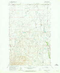
1962 Map of Whitlash
USGS Topo · Published 1964About this map
Whitlash stands as the primary outpost on the high plains of northern Montana in the early 1960s, situated just south of the Canada United States international border. This boundary-spanning survey highlights a landscape defined by ranching and energy extraction, where the Whitlash Gas and Oil Field and Arch Apex Gas Field are dotted with numerous oil wells and gas wells. The presence of the U S Customs office at the border and a dedicated Landing Strip underscores the logistical importance of this remote area.
Find a feature on this map
29 named features on this map. Tap any name to fly to it.
Don’t see what you’re looking for? This feature index may not catch every label — zoom into the map to look around manually.
Map Details
Editions of this 1962 Whitlash Map
2 editions found
Other maps of this area

1954 · Shelby
USGS Topo · 1:250,000

1958 · Shelby
USGS Topo · 1:250,000

1962 · Whitlash
USGS Topo · 1:24,000

1962 · Cameron Lake
USGS Topo · 1:24,000

1962 · Fey Lakes
USGS Topo · 1:24,000
1962 · Hawley Hill
USGS Topo · 1:24,000

1962 · Haystack Butte
USGS Topo · 1:24,000

1962 · Grassy Butte
USGS Topo · 1:24,000

1984 · Sweet Grass Hills
USGS Topo · 1:100,000
2011 · Fey Lakes
USGS Topo · 1:24,000