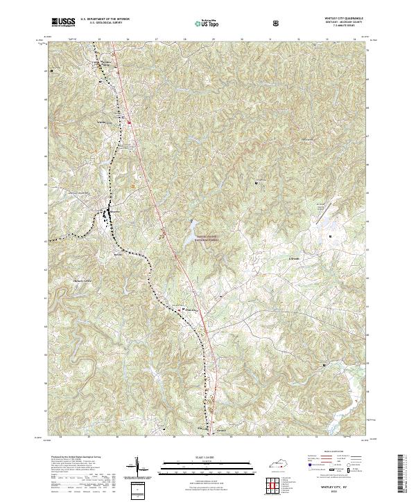
2022 Map of Whitley City
USGS Topo · Published 2022About this map
Whitley City serves as the focal point for this McCreary County corridor, anchored by the McCreary County Courthouse and the Somerset Community College McCreary Center. The landscape follows the spine of US Hwy 27 and the historic State Hwy 1651, linking a series of settlements including Marshes Siding, Stearns, Revelo, and Pine Knot. These communities are situated within the eastern reaches of the Daniel Boone National Forest, where the terrain is deeply dissected by drainages like Roaring Paunch Creek and Bridge Fork. For genealogists and local historians, the map identifies numerous family burial grounds such as Carter Cem, Hollaway Cem, and Gilreath Cem. The concentration of infrastructure near Stearns and the presence of the Mc Creary County Airport illustrate the modern development pattern of this Appalachian plateau region, while trails like the Lick Creek Trl indicate the enduring recreational value of the surrounding forest.
Find a feature on this map
51 named features on this map. Tap any name to fly to it.
Don’t see what you’re looking for? This feature index may not catch every label — zoom into the map to look around manually.
Map Details
Editions of this 2022 Whitley City Map
This is the sole edition of this map. No revisions or reprints were ever made.
Other maps of this area

1890 · Williamsburg
USGS Topo · 1:125,000

1894 · Williamsburg
USGS Topo · 1:125,000

1932 · Burnside
USGS Topo · 1:62,500

1934 · Barthell
USGS Topo · 1:62,500

1952 · Hollyhill
USGS Topo · 1:24,000

1952 · Wiborg
USGS Topo · 1:24,000

1952 · Cumberland Falls
USGS Topo · 1:24,000

1952 · Whitley City
USGS Topo · 1:24,000
1953 · Winfield
USGS Topo · 1:24,000
1953 · Ketchen
USGS Topo · 1:24,000