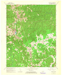
1963 Map of Whitley City
USGS Topo · Published 1966About this map
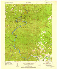
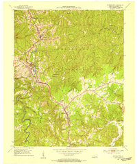
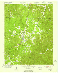
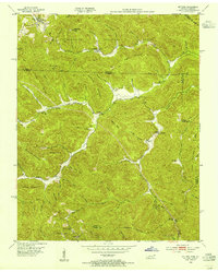
Whitley City and Pine Knot serve as the primary population centers in this 1960s study of the McCreary County plateau. The landscape is defined by the Southern railroad corridor and the smaller Kentucky and Tennessee line, which connect these upland communities to the surrounding coal and timber lands. A significant portion of the quadrangle is occupied by the Cumberland National Forest, characterized by a dense network of drainages including Roaring Paunch Creek and Lick Fork. Local history is preserved in the numerous rural landmarks, such as Silerville (Strunk PO), Mt Pleasant Sch, and a series of small country churches like East Apple Tree Ch and Meadow Grove Ch. Evidence of the region's industrial activity is visible in the form of a Strip Mine, set against the backdrop of the undulating terrain and family cemeteries like the Gilreath Cem.
Find a feature on this map
43 named features on this map. Tap any name to fly to it.
Don’t see what you’re looking for? This feature index may not catch every label — zoom into the map to look around manually.
Map Details
Editions of this 1963 Whitley City Map
This is the sole edition of this map. No revisions or reprints were ever made.
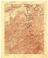
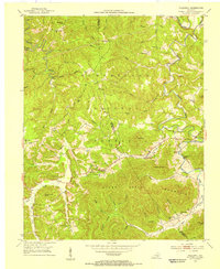
Other maps of this area

1890 · Williamsburg
USGS Topo · 1:125,000

1894 · Williamsburg
USGS Topo · 1:125,000
1932 · Burnside
USGS Topo · 1:62,500

1934 · Barthell
USGS Topo · 1:62,500
1952 · Hollyhill
USGS Topo · 1:24,000
1952 · Wiborg
USGS Topo · 1:24,000
1952 · Cumberland Falls
USGS Topo · 1:24,000
1952 · Whitley City
USGS Topo · 1:24,000
1953 · Winfield
USGS Topo · 1:24,000
1953 · Ketchen
USGS Topo · 1:24,000