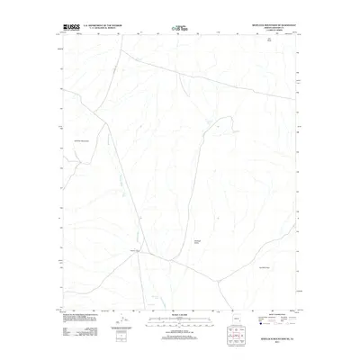
2011 Map of Whitlock Mountains NE
USGS Topo · Published 2011About this map
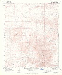
Hackberry Ranch serves as a central landmark in this high-desert landscape of Graham County, situated where Hackberry Rd meets the drainage of Whitlock Wash. This 2011 survey illustrates a region defined by arid-land ranching infrastructure, with numerous water catchments like Cedar Tank, Mud Hole Tank, and Soapweed Tank scattered across the basin. The terrain is dominated by the broad expanse of the Whitlock Valley, flanked by the rising elevations of the Whitlock Mountains to the west and the prominent Ash Peak to the northeast. To the southeast, the landscape transitions into Hot Well Draw, showing the intricate network of seasonal watercourses that shape the local topography. This map documents the essential water sources and primitive road networks required to navigate and manage this remote part of the Arizona desert during the early 21st century.
Find a feature on this map
13 named features on this map. Tap any name to fly to it.
Don’t see what you’re looking for? This feature index may not catch every label — zoom into the map to look around manually.
Map Details
Editions of this 2011 Whitlock Mountains NE Map
This is the sole edition of this map. No revisions or reprints were ever made.
Other maps of this area

1954 · Silver City
USGS Topo · 1:250,000

1958 · Silver City
USGS Topo · 1:250,000

1959 · York Valley
USGS Topo · 1:62,500

1960 · Guthrie
USGS Topo · 1:62,500

1960 · Duncan
USGS Topo · 1:62,500

1962 · Silver City
USGS Topo · 1:250,000
1966 · Javelina Peak
USGS Topo · 1:24,000
1966 · Whitlock Cienega
USGS Topo · 1:24,000
1966 · Whitlock Mts. NE
USGS Topo · 1:24,000
1966 · Dry Mountain
USGS Topo · 1:24,000