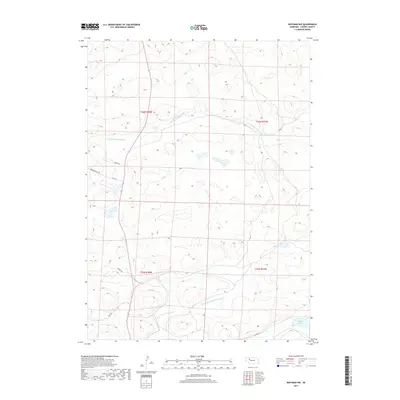
2017 Map of Whitman NW
USGS Topo · Published 2017About this map
The N Br Middle Loup River and the Middle Br Middle Loup River define the hydrography of this section of the Nebraska Sandhills. Located in Cherry County, the terrain is characterized by the complex drainage patterns of these river branches and the presence of seasonal and permanent water bodies like Krumpf Lake. The sparse network of local roads, such as Ambler Dr, Ponderosa Rd, and Essie Rd, follows the natural contours of the undulating landscape, reflecting the remote ranching and agricultural character of the region. This survey highlights the intricate relationship between the river forks and the low-lying basins that dot the sand dunes, providing a detailed look at the water resources and rural access points in the western reaches of the state.
Find a feature on this map
13 named features on this map. Tap any name to fly to it.
Don’t see what you’re looking for? This feature index may not catch every label — zoom into the map to look around manually.
Map Details
Editions of this 2017 Whitman NW Map
This is the sole edition of this map. No revisions or reprints were ever made.
Other maps of this area

1948 · Ashby
USGS Topo · 1:62,500

1948 · Whitman
USGS Topo · 1:62,500

1949 · Ashby
USGS Topo · 1:62,500

1949 · Steverson Lake
USGS Topo · 1:62,500

1949 · Turpin Lake
USGS Topo · 1:62,500

1950 · Whitman
USGS Topo · 1:62,500

1951 · Steverson Lake
USGS Topo · 1:62,500

1951 · Turpin Lake
USGS Topo · 1:62,500

1957 · Valentine
USGS Topo · 1:250,000

1959 · Valentine
USGS Topo · 1:250,000