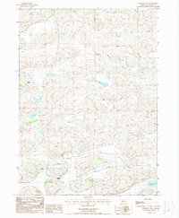
1987 Map of Whitman NW
USGS Topo · Published 1988About this map
The North Branch Middle Loup River and Middle Branch Middle Loup River wind through this corner of Cherry County, defining a landscape of braided waterways and low-lying wetlands. Ranching interests are central to the local geography in the late 1980s, marked by established operations such as the Rothwell Ranch and Dumbbell Ranch. The presence of the Red Mill School indicates a persistent community infrastructure in this rural Nebraska expanse, where water management is highlighted by several Flowing Wells and a notable Spoil Bank near the river forks. In the southeast, Krumpf Lake provides a clear landmark among the hills, while the "Middle Branch" label further identifies the intricate drainage network that feeds into the Loup River system. This provisional data reflects the region's agricultural character and the essential role of groundwater in sustaining local ranch life.
Find a feature on this map
10 named features on this map. Tap any name to fly to it.
Don’t see what you’re looking for? This feature index may not catch every label — zoom into the map to look around manually.
Map Details
Editions of this 1987 Whitman NW Map
This is the sole edition of this map. No revisions or reprints were ever made.
Other maps of this area

1948 · Ashby
USGS Topo · 1:62,500

1948 · Whitman
USGS Topo · 1:62,500

1949 · Ashby
USGS Topo · 1:62,500

1949 · Steverson Lake
USGS Topo · 1:62,500

1949 · Turpin Lake
USGS Topo · 1:62,500

1950 · Whitman
USGS Topo · 1:62,500

1951 · Steverson Lake
USGS Topo · 1:62,500

1951 · Turpin Lake
USGS Topo · 1:62,500

1957 · Valentine
USGS Topo · 1:250,000

1959 · Valentine
USGS Topo · 1:250,000