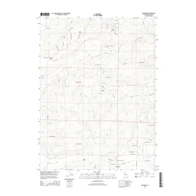
2015 Map of Whitmore
USGS Topo · Published 2015About this map
Whitmore and Fern anchor this northern California landscape, where the foothills of the Cascades meet a complex network of creeks and ridges. The terrain is defined by dramatic elevation changes, notably at Bullskin Ridge and Gold Hill, while numerous drainages such as Old Cow Creek and Clover Creek carve through the land. The map reveals a rural community structure established around timber and ranching, evidenced by features like Coal Gulch and Little Valley. Local family history is preserved at the Fern Cemetery and Whitmore Cemetery, while a dense web of local roads, including Pollock Ranch Road and Amidon Ranch Road, traces the historic land use patterns of Shasta County. The layout of the townships, including t33n r1w and t32n r1e, provides the underlying framework for these scattered settlements and remote homesteads.
Find a feature on this map
61 named features on this map. Tap any name to fly to it.
Don’t see what you’re looking for? This feature index may not catch every label — zoom into the map to look around manually.
Map Details
Editions of this 2015 Whitmore Map
This is the sole edition of this map. No revisions or reprints were ever made.
Other maps of this area

1886 · Lassen Peak
USGS Topo · 1:250,000

1890 · Red Bluff
USGS Topo · 1:250,000

1892 · Lassen Peak
USGS Topo · 1:250,000

1894 · Lassen Peak
USGS Topo · 1:250,000

1894 · Red Bluff
USGS Topo · 1:250,000

1901 · Redding
USGS Topo · 1:125,000

1935 · Burney
USGS Topo · 1:96,000

1939 · Burney
USGS Topo · 1:125,000

1949 · Bollibokka Mtn
USGS Topo · 1:62,500

1953 · Millville
USGS Topo · 1:62,500