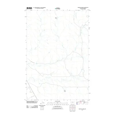
2011 Map of Whitney Creek
USGS Topo · Published 2011About this map
North Woman Creek and the drainage of Whitney Creek define the ranching landscape of Custer County in this early 21st-century survey. The terrain is a network of intermittent stream beds and carefully managed water resources, evidenced by the Murray Number 1 Dam in the north and the Hirsch Number 1 Dam further south. These features, along with Bircher Springs and Finn Springs, indicate the vital role of water management for livestock in this semi-arid environment. Infrastructure is sparse but purposeful, consisting primarily of private ranch access and county routes like Murray Pasture Rd and the Tongue River Rd skirting the southwestern corner. The naming conventions of the waterways, including Log Creek and Mill Creek, suggest a history of early land use and local industry centered on these vital corridors.
Find a feature on this map
12 named features on this map. Tap any name to fly to it.
Don’t see what you’re looking for? This feature index may not catch every label — zoom into the map to look around manually.
Map Details
Editions of this 2011 Whitney Creek Map
This is the sole edition of this map. No revisions or reprints were ever made.
Other maps of this area

1953 · Miles City
USGS Topo · 1:250,000

1957 · Miles City
USGS Topo · 1:250,000

1958 · Miles City
USGS Topo · 1:250,000

1968 · Miles City
USGS Topo · 1:24,000

1968 · Paddy Fay Creek
USGS Topo · 1:24,000

1969 · Horse Creek
USGS Topo · 1:24,000

1969 · Haines Springs
USGS Topo · 1:24,000

1969 · Circle L Creek
USGS Topo · 1:24,000

1969 · First Creek
USGS Topo · 1:24,000

1969 · Government Hill
USGS Topo · 1:24,000