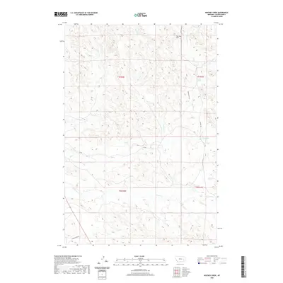
2020 Map of Whitney Creek
USGS Topo · Published 2020About this map
The Pine Hills dominate the topography of this corner of Custer County, where the high ridges of the divide separate the drainages of the Tongue River watershed. The landscape is defined by an intricate network of intermittent stream beds and named water sources that were essential for early ranching, such as Bircher Springs and Finn Springs. This 2020 survey shows the remote nature of the region, where access is limited to gravel routes like Murray Ranch Rd and Country Rd. The drainage systems of Whitney Cr and Log Cr flow north toward the Yellowstone valley, while the southern portion of the quadrangle is marked by the headwaters of N Woman Cr. The map preserves the specific cattle-country geography of eastern Montana, tracing the historic township and range lines across a terrain primarily shaped by the erosive forces of Mill Cr and its various forks.
Find a feature on this map
17 named features on this map. Tap any name to fly to it.
Don’t see what you’re looking for? This feature index may not catch every label — zoom into the map to look around manually.
Map Details
Editions of this 2020 Whitney Creek Map
This is the sole edition of this map. No revisions or reprints were ever made.
Other maps of this area

1953 · Miles City
USGS Topo · 1:250,000

1957 · Miles City
USGS Topo · 1:250,000

1958 · Miles City
USGS Topo · 1:250,000

1968 · Miles City
USGS Topo · 1:24,000

1968 · Paddy Fay Creek
USGS Topo · 1:24,000

1969 · Horse Creek
USGS Topo · 1:24,000

1969 · Haines Springs
USGS Topo · 1:24,000

1969 · Circle L Creek
USGS Topo · 1:24,000

1969 · First Creek
USGS Topo · 1:24,000

1969 · Government Hill
USGS Topo · 1:24,000