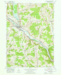
1949 Map of Whitney Point
USGS Topo · Published 1967About this map
The Whitney Point Flood Control Dam dominates the northern landscape, managing the confluence where the Otselic River meets the Tioughnioga River. This post-war era survey shows the village of Whitney Point as a regional hub, complete with its Fairgrounds and proximity to the Delaware Lackawanna and Western Railroad. The valley floor is marked by active transit corridors, including the ancient route of the Catskill Turnpike, while the surrounding uplands like Kales Hill and Pendell Hill remain largely rural.
Find a feature on this map
46 named features on this map. Tap any name to fly to it.
Don’t see what you’re looking for? This feature index may not catch every label — zoom into the map to look around manually.
Map Details
Editions of this 1949 Whitney Point Map
3 editions found
Other maps of this area

1901 · Apalachin
USGS Topo · 1:62,500

1903 · Harford
USGS Topo · 1:62,500

1904 · Binghamton
USGS Topo · 1:62,500

1904 · Greene
USGS Topo · 1:62,500

1904 · Apalachin
USGS Topo · 1:62,500

1906 · Catatonk
USGS Topo · 1:125,000

1934 · Castle Creek
USGS Topo · 1:24,000

1935 · Chenango Forks
USGS Topo · 1:24,000

1942 · Castle Creek
USGS Topo · 1:31,680

1942 · Chenango Forks
USGS Topo · 1:31,680