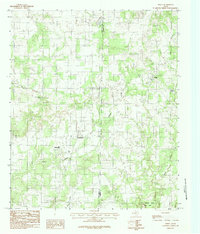
1984 Map of Whitt
USGS Topo · Published 1984About this map
Whitt and the surrounding ranching country of the Palo Pinto and Parker County line are captured in this mid-1980s USGS survey. The landscape is defined by the network of seasonal drainages, including Turkey Creek, Rock Creek, and Salt Branch, which carve through the terrain. Small rural centers like Peadenville and Salesville serve as the primary hubs for the scattered homesteads and agricultural operations that mark this region of North Central Texas.
Find a feature on this map
12 named features on this map. Tap any name to fly to it.
Don’t see what you’re looking for? This feature index may not catch every label — zoom into the map to look around manually.
Map Details
Editions of this 1984 Whitt Map
This is the sole edition of this map. No revisions or reprints were ever made.
Other maps of this area

1891 · Weatherford
USGS Topo · 1:125,000

1891 · Palo Pinto
USGS Topo · 1:125,000

1893 · Weatherford
USGS Topo · 1:125,000

1918 · Palo Pinto
USGS Topo · 1:125,000

1924 · Palo Pinto 1-b
USGS Topo · 1:48,000

1927 · Mineral Wells
USGS Topo · 1:62,500

1954 · Dallas
USGS Topo · 1:250,000

1954 · Sherman
USGS Topo · 1:250,000

1954 · Abilene
USGS Topo · 1:250,000

1954 · Wichita Falls
USGS Topo · 1:250,000