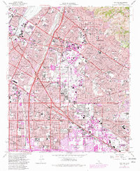
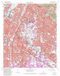
1965 Map of Whittier
USGS Topo · Published 1982About this map
The Puente Hills define the northeastern corner of this urban landscape, where landmarks like Workman Hill overlook the expanding valley floor. This 1965 survey, updated with 1981 purple-tinted revisions, reveals a complex network of residential growth and industry organized around the San Gabriel River and Rio Hondo. The map documents a significant era of institutional and educational development, featuring Whittier College, the expansive Metropolitan State Hospital, and a U S Military Reservation near Norwalk.
Find a feature on this map
71 named features on this map. Tap any name to fly to it.
Don’t see what you’re looking for? This feature index may not catch every label — zoom into the map to look around manually.
Map Details
Editions of this 1965 Whittier Map
5 editions found
Other maps of this area

1894 · Los Angeles
USGS Topo · 1:62,500

1894 · Pomona
USGS Topo · 1:62,500

1896 · Pasadena
USGS Topo · 1:62,500

1896 · Anaheim
USGS Topo · 1:62,500

1896 · Downey
USGS Topo · 1:62,500

1897 · Pomona
USGS Topo · 1:62,500

1898 · Pomona
USGS Topo · 1:62,500

1898 · Anaheim
USGS Topo · 1:62,500

1899 · Downey
USGS Topo · 1:62,500

1900 · Pasadena
USGS Topo · 1:62,500