
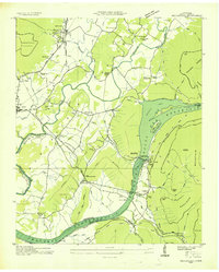
1936 Map of Whitwell
USGS Topo · Published 1936About this map
The Whitwell valley and the adjacent Cumberland Plateau are captured here during a period of industrial transition. The Nashville Chattanooga and St Louis railroad serves as a central artery for the region, supporting a coal-driven economy evidenced by a prominent Coal Chute and several Incline rail segments climbing the steep plateau slopes. Near the Sequatchie River, traditional landmarks like Ketner Mill and Lane Chapel anchor the rural landscape.
Find a feature on this map
49 named features on this map. Tap any name to fly to it.
Don’t see what you’re looking for? This feature index may not catch every label — zoom into the map to look around manually.
Map Details
Editions of this 1936 Whitwell Map
This is the sole edition of this map. No revisions or reprints were ever made.
Other maps of this area

1888 · Chattanooga
USGS Topo · 1:125,000

1893 · Chattanooga
USGS Topo · 1:125,000

1895 · Sewanee
USGS Topo · 1:125,000

1936 · Palmer
USGS Topo · 1:24,000

1936 · Daus
USGS Topo · 1:24,000

1936 · Tracy City
USGS Topo · 1:24,000

1936 · Ketner Gap
USGS Topo · 1:24,000

1936 · White City
USGS Topo · 1:24,000

1936 · Wauhatchie
USGS Topo · 1:24,000
1936 · Sequatchie
USGS Topo · 1:24,000