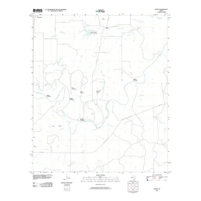
2010 Map of Whon
USGS Topo · Published 2010About this map
Whon and the surrounding ranchlands of Coleman County are defined by the meandering path of the Colorado River, which carves through a landscape of low rises like Parks Mountain and Round Mountain. In the early 21st century, this area remains characterized by rural crossings and water management, notably at the Soil Conservation Service Site 22 Dam and its reservoir on Camp Creek. The map records several river access points that speak to the historical transit of the region, including Walker Crossing, Knight Crossing, Military Crossing, and Mitchell Crossing.
Find a feature on this map
37 named features on this map. Tap any name to fly to it.
Don’t see what you’re looking for? This feature index may not catch every label — zoom into the map to look around manually.
Map Details
Editions of this 2010 Whon Map
This is the sole edition of this map. No revisions or reprints were ever made.
Other maps of this area

1887 · Coleman
USGS Topo · 1:125,000

1889 · Coleman
USGS Topo · 1:125,000

1894 · Brady
USGS Topo · 1:125,000

1924 · Brady 2-a
USGS Topo · 1:48,000

1925 · Brady 2-b
USGS Topo · 1:48,000

1925 · Brady 1-b
USGS Topo · 1:48,000

1928 · Mercury
USGS Topo · 1:62,500

1928 · Waldrip
USGS Topo · 1:62,500

1950 · Mercury
USGS Topo · 1:62,500

1954 · Brownwood
USGS Topo · 1:250,000