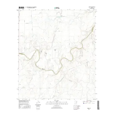
2016 Map of Whon
USGS Topo · Published 2016About this map
The Colorado River carves a deep, winding path through the central Texas landscape along the border of Coleman and McCulloch counties. This ranching and agricultural region is anchored by the small community of Whon, situated north of the river near several water management features, including the Soil Conservation Service Site 22 Reservoir and the headwaters of Camp Cr. The terrain is defined by prominent elevations such as Parks Mtn and Round Mtn, which rise above the surrounding creek drainages. Local family history is preserved at the Whon Cem and the more isolated Fife Cem to the southwest. Transport in the area relies on a network of rural routes like Ranch Rd 765, providing access to remote locations like Deer Hollow and the River Bend Ranch Airport, reflecting the region's low-density settlement and reliance on river-bottom topography.
Find a feature on this map
35 named features on this map. Tap any name to fly to it.
Don’t see what you’re looking for? This feature index may not catch every label — zoom into the map to look around manually.
Map Details
Editions of this 2016 Whon Map
This is the sole edition of this map. No revisions or reprints were ever made.
Other maps of this area

1887 · Coleman
USGS Topo · 1:125,000

1889 · Coleman
USGS Topo · 1:125,000

1894 · Brady
USGS Topo · 1:125,000

1924 · Brady 2-a
USGS Topo · 1:48,000

1925 · Brady 2-b
USGS Topo · 1:48,000

1925 · Brady 1-b
USGS Topo · 1:48,000

1928 · Mercury
USGS Topo · 1:62,500

1928 · Waldrip
USGS Topo · 1:62,500

1950 · Mercury
USGS Topo · 1:62,500

1954 · Brownwood
USGS Topo · 1:250,000