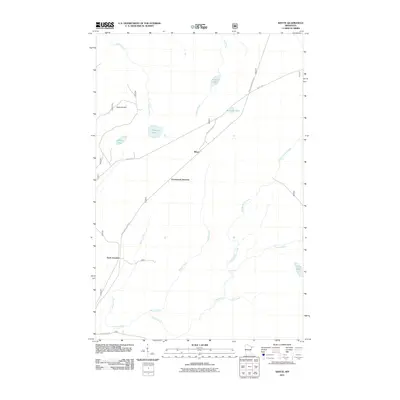
2011 Map of Whyte
USGS Topo · Published 2011About this map
Whyte and its surrounding rail-influenced junctions sit at the heart of this North Woods landscape, where transportation corridors once dictated the movement of timber and iron. The small settlement is framed by a dense network of forest routes, including Stony River Forest Rd and Whyte Rd, which cut through a terrain defined more by its water than its elevation. Notable hydrologic features such as the Cloquet River and the Stony River drain the region, while evocative names like Phantom Lake, Driller Lake, and Railroad Lake hint at the industry and exploration that shaped this part of Lake County. Significant transit points like Greenwood Junction and Scott Junction mark the historic meeting of paths in the Superior National Forest area, providing a precise look at the 2011 infrastructure before further natural succession or modern forest management altered these clearings.
Find a feature on this map
20 named features on this map. Tap any name to fly to it.
Don’t see what you’re looking for? This feature index may not catch every label — zoom into the map to look around manually.
Map Details
Editions of this 2011 Whyte Map
This is the sole edition of this map. No revisions or reprints were ever made.
Other maps of this area

1953 · Whyte
USGS Topo · 1:62,500

1954 · Greenwood Lake
USGS Topo · 1:62,500

1954 · Silver Bay
USGS Topo · 1:62,500

1954 · Two Harbors
USGS Topo · 1:250,000

1955 · Isabella
USGS Topo · 1:62,500

1957 · Two Harbors
USGS Topo · 1:250,000

1958 · Two Harbors
USGS Topo · 1:250,000

1964 · Two Harbors
USGS Topo · 1:250,000

1976 · Two Harbors
USGS Topo · 1:100,000
1981 · Legler Lake
USGS Topo · 1:24,000