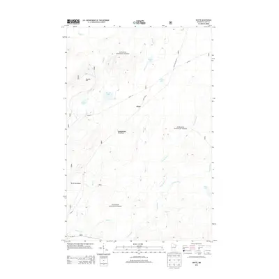
2013 Map of Whyte
USGS Topo · Published 2013About this map
Superior National Forest encompasses the entirety of this landscape, where the iron-range legacy and timber history are etched into the drainage patterns of the Cloquet River and Stony River. The map highlights a network of forest transport and rail junctions, most notably Whyte, which serves as a central point for Forest Rte 395 and Whyte Rd. To the west and south, Greenwood Junction and Scott Junction mark critical nodes in the local infrastructure. The terrain is characterized by numerous small lakes and named watercourses like Phantom Lake and Driller Lake, alongside the prominent Peabody Hill. This 2013 survey provides a clear look at the hydrologic headwaters in the region, including Source Lake and the winding course of Lillian Cr, reflecting the modern management of these protected Minnesota woodlands.
Find a feature on this map
23 named features on this map. Tap any name to fly to it.
Don’t see what you’re looking for? This feature index may not catch every label — zoom into the map to look around manually.
Map Details
Editions of this 2013 Whyte Map
This is the sole edition of this map. No revisions or reprints were ever made.
Other maps of this area

1953 · Whyte
USGS Topo · 1:62,500

1954 · Greenwood Lake
USGS Topo · 1:62,500

1954 · Silver Bay
USGS Topo · 1:62,500

1954 · Two Harbors
USGS Topo · 1:250,000

1955 · Isabella
USGS Topo · 1:62,500

1957 · Two Harbors
USGS Topo · 1:250,000

1958 · Two Harbors
USGS Topo · 1:250,000

1964 · Two Harbors
USGS Topo · 1:250,000

1976 · Two Harbors
USGS Topo · 1:100,000
1981 · Legler Lake
USGS Topo · 1:24,000