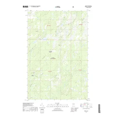
2019 Map of Whyte
USGS Topo · Published 2019About this map
Superior National Forest encompasses this section of Lake County, where a legacy of timber and transport is etched into the landscape. The settlement of Whyte and strategic points like Greenwood Junction and Scott Junction anchor a network of forest roads and former grades, including the Stoney River Grade and the Whyte Spur A. These routes trace the historical movement of resources through a region defined by its complex hydrology and glacial topography. Significant water bodies such as Source Lake, Railroad Lake, and Phantom Lake dot the map, while the Cloquet River and Stony River drain the surrounding wetlands. To the west, Peabody Hill provides a rare point of elevation overlooking the numerous creeks, including Cloudy Spring Cr, White Cr, and Murphy Cr, that lattice the forest floor. The map serves as a primary reference for the industrial and natural geography of northeastern Minnesota.
Find a feature on this map
30 named features on this map. Tap any name to fly to it.
Don’t see what you’re looking for? This feature index may not catch every label — zoom into the map to look around manually.
Map Details
Editions of this 2019 Whyte Map
This is the sole edition of this map. No revisions or reprints were ever made.
Other maps of this area

1953 · Whyte
USGS Topo · 1:62,500

1954 · Greenwood Lake
USGS Topo · 1:62,500

1954 · Silver Bay
USGS Topo · 1:62,500

1954 · Two Harbors
USGS Topo · 1:250,000

1955 · Isabella
USGS Topo · 1:62,500

1957 · Two Harbors
USGS Topo · 1:250,000

1958 · Two Harbors
USGS Topo · 1:250,000

1964 · Two Harbors
USGS Topo · 1:250,000

1976 · Two Harbors
USGS Topo · 1:100,000
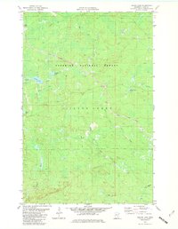
1981 · Legler Lake
USGS Topo · 1:24,000