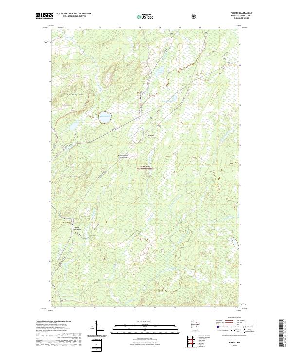
2022 Map of Whyte
USGS Topo · Published 2022About this map
Superior National Forest defines the character of this Lake County landscape, where water and former transportation routes dictate the geography. The map traces the course of the Cloquet River and the Stony River, along with numerous tributaries like Cloudy Spring Cr and Lillian Cr. The legacy of the region's logging or industrial history is evident in the naming of the Stoney River Grade, Whyte Spur A, and the Spur End Creek, suggesting a terrain once heavily shaped by rail activity. Small settlements such as Whyte, Greenwood Junction, and Scott Junction serve as quiet landmarks within this dense woodland. Near the northern boundary, Peabody Hill provides a distinct topographic rise above a series of named basins, including Source Lake, Railroad Lake, and Phantom Lake. The presence of roads like Bassett Road and Toimi Road provides access into this remote northern Minnesota timberland.
Find a feature on this map
29 named features on this map. Tap any name to fly to it.
Don’t see what you’re looking for? This feature index may not catch every label — zoom into the map to look around manually.
Map Details
Editions of this 2022 Whyte Map
This is the sole edition of this map. No revisions or reprints were ever made.
Other maps of this area

1953 · Whyte
USGS Topo · 1:62,500

1954 · Greenwood Lake
USGS Topo · 1:62,500

1954 · Silver Bay
USGS Topo · 1:62,500

1954 · Two Harbors
USGS Topo · 1:250,000

1955 · Isabella
USGS Topo · 1:62,500

1957 · Two Harbors
USGS Topo · 1:250,000

1958 · Two Harbors
USGS Topo · 1:250,000

1964 · Two Harbors
USGS Topo · 1:250,000

1976 · Two Harbors
USGS Topo · 1:100,000
1981 · Legler Lake
USGS Topo · 1:24,000