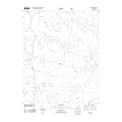
2010 Map of Wiborg
USGS Topo · Published 2010About this map
Beulah Heights and Wiborg sit amidst a complex network of ridges and watercourses in this McCreary County study. The landscape is defined by its deep hollows and elevated ridges, including Pole Road Hollow and Big Swag Ridge, which dictate the placement of early settlements and roads. The presence of the Stearns District Ranger Office reflects the region's managed forest environment, while smaller communities like Flat Rock and Greenwood appear linked by rural routes and family-named landmarks.
Find a feature on this map
51 named features on this map. Tap any name to fly to it.
Don’t see what you’re looking for? This feature index may not catch every label — zoom into the map to look around manually.
Map Details
Editions of this 2010 Wiborg Map
This is the sole edition of this map. No revisions or reprints were ever made.
Other maps of this area

1890 · Williamsburg
USGS Topo · 1:125,000

1894 · Williamsburg
USGS Topo · 1:125,000

1932 · Burnside
USGS Topo · 1:62,500

1934 · Barthell
USGS Topo · 1:62,500

1952 · Hail
USGS Topo · 1:24,000

1952 · Hollyhill
USGS Topo · 1:24,000

1952 · Wiborg
USGS Topo · 1:24,000

1952 · Cumberland Falls
USGS Topo · 1:24,000

1952 · Whitley City
USGS Topo · 1:24,000
1952 · Sawyer
USGS Topo · 1:24,000