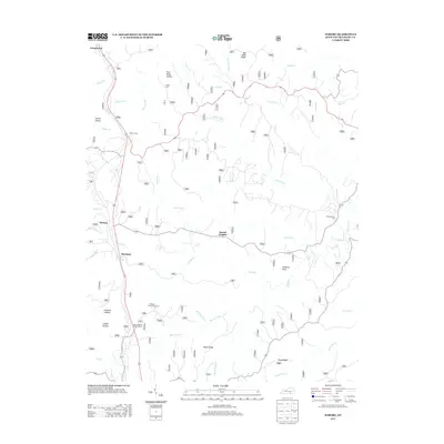
2013 Map of Wiborg
USGS Topo · Published 2013About this map
Beulah Heights and Wiborg sit along the primary transport corridor of this McCreary County landscape, where the ridge-top settlements overlook a complex drainage system. The terrain is defined by deep incisions like Franklin Hollow and Spruce Hollow, which feed into major watercourses such as Indian Cr and Barren Fork. For genealogists and local historians, several burial grounds are preserved on these heights, including Hughes Cem near Pole Road Hollow and Hickenbottom Cem to the east. The presence of the Stearns District Ranger Office near Flat Rock highlights the area's significance within managed forest lands. The map reveals a distinct development pattern where roads and small communities like Parkers Lake and Greenwood cling to the elevated divides of Taylor Ridge and Pond Ridge, avoiding the steep descents into the creek forks below.
Find a feature on this map
40 named features on this map. Tap any name to fly to it.
Don’t see what you’re looking for? This feature index may not catch every label — zoom into the map to look around manually.
Map Details
Editions of this 2013 Wiborg Map
This is the sole edition of this map. No revisions or reprints were ever made.
Other maps of this area

1890 · Williamsburg
USGS Topo · 1:125,000

1894 · Williamsburg
USGS Topo · 1:125,000

1932 · Burnside
USGS Topo · 1:62,500

1934 · Barthell
USGS Topo · 1:62,500

1952 · Hail
USGS Topo · 1:24,000

1952 · Hollyhill
USGS Topo · 1:24,000

1952 · Wiborg
USGS Topo · 1:24,000

1952 · Cumberland Falls
USGS Topo · 1:24,000

1952 · Whitley City
USGS Topo · 1:24,000
1952 · Sawyer
USGS Topo · 1:24,000