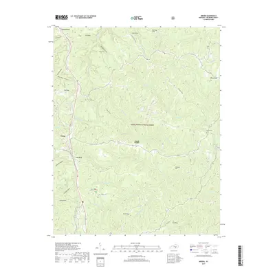
2019 Map of Wiborg
USGS Topo · Published 2019About this map
Daniel Boone National Forest dominates this McCreary County landscape, where the deeply dissected plateau of southeastern Kentucky creates a complex network of ridges and hollows. Small upland settlements like Wiborg, Beulah Heights, and Greenwood occupy the relatively level ground along the western corridor, while the interior is defined by sharp topographic drops into drainages such as Barren Fork and Kilburn Fork.
Find a feature on this map
49 named features on this map. Tap any name to fly to it.
Don’t see what you’re looking for? This feature index may not catch every label — zoom into the map to look around manually.
Map Details
Editions of this 2019 Wiborg Map
This is the sole edition of this map. No revisions or reprints were ever made.
Other maps of this area

1890 · Williamsburg
USGS Topo · 1:125,000

1894 · Williamsburg
USGS Topo · 1:125,000

1932 · Burnside
USGS Topo · 1:62,500

1934 · Barthell
USGS Topo · 1:62,500

1952 · Hail
USGS Topo · 1:24,000

1952 · Hollyhill
USGS Topo · 1:24,000

1952 · Wiborg
USGS Topo · 1:24,000

1952 · Cumberland Falls
USGS Topo · 1:24,000

1952 · Whitley City
USGS Topo · 1:24,000
1952 · Sawyer
USGS Topo · 1:24,000