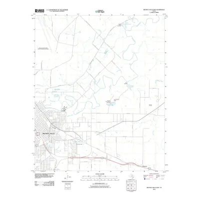
2010 Map of Wichita Falls East
USGS Topo · Published 2010About this map
Wichita Falls expands eastward in this detailed 2010 survey, where the urban grid meets the agricultural reaches of Wichita County. The Wichita River and Holliday Creek serve as the primary hydrologic landmarks, winding through a landscape increasingly defined by managed water resources like the Parker Estate Lake, Henry Lake, and the Seventy-Seven Ranch Lake. These private ranch lakes and the North Side Canal illustrate the region's reliance on irrigation and water storage for both livestock and land management.
Find a feature on this map
61 named features on this map. Tap any name to fly to it.
Don’t see what you’re looking for? This feature index may not catch every label — zoom into the map to look around manually.
Map Details
Editions of this 2010 Wichita Falls East Map
This is the sole edition of this map. No revisions or reprints were ever made.
Other maps of this area

1915 · Burkburnett
USGS Topo · 1:24,000

1918 · Buckburnett
USGS Topo · 1:31,680

1954 · Wichita Falls
USGS Topo · 1:250,000

1955 · Lawton
USGS Topo · 1:250,000

1956 · Sloop Creek
USGS Topo · 1:24,000

1956 · Lake Wichita
USGS Topo · 1:24,000

1957 · Wichita Falls West
USGS Topo · 1:24,000

1957 · Burkburnett
USGS Topo · 1:62,500

1957 · Randlett
USGS Topo · 1:62,500

1957 · Wichita Falls East
USGS Topo · 1:62,500