
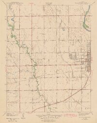
1943 Map of Wichita West
USGS Topo · Published 1943About this map
Arkansas River and Big Slough define the eastern drainage of this Kansas landscape, where the growing western edge of Wichita meets a grid of rural townships. The 1940 survey documents a transition from the urban density of Eugene Field Sch and the County Hospital to the agricultural expanses of Delano and Attica. A dense network of local education centers, including the Rising Sun Sch and Prairie Center Sch, highlights the importance of neighborhood school districts in the early 20th century.
Find a feature on this map
33 named features on this map. Tap any name to fly to it.
Don’t see what you’re looking for? This feature index may not catch every label — zoom into the map to look around manually.
Map Details
Editions of this 1943 Wichita West Map
2 editions found
Other maps of this area

1889 · Cheney
USGS Topo · 1:125,000

1889 · Wichita
USGS Topo · 1:125,000

1891 · Cheney
USGS Topo · 1:125,000

1894 · Wichita
USGS Topo · 1:125,000

1901 · Cheney
USGS Topo · 1:125,000

1941 · Maize
USGS Topo · 1:31,680

1941 · Valley Center
USGS Topo · 1:31,680

1942 · Valley Center
USGS Topo · 1:31,680

1942 · Maize
USGS Topo · 1:31,680

1943 · Wichita East
USGS Topo · 1:31,680