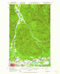
1951 Map of Wickersham
USGS Topo · Published 1962About this map
Sedro-Woolley and the massive grounds of the Northern State Hospital anchor the southwestern corner of this survey, which follows the industrial and natural corridors of the Skagit and Nooksack valleys. The landscape reflects a mid-century economy built on extraction and transport, evidenced by the Cokedale Mine and Soundview Logging Camp 17. The South Fork Nooksack River and Skagit River serve as the primary geographical markers, with the rail infrastructure of the Northern Pacific, Great Northern, and Pacific Northern lines connecting timber and mining outposts. Local social centers like the Skitopa Grange and Samish School appear alongside small settlements such as Wickersham, Acme, and Lyman. Of particular interest to local historians is the recorded Lyman Ferry (Site), noting a former river crossing point that had been superseded by the time of the 1951 revision.
Find a feature on this map
87 named features on this map. Tap any name to fly to it.
Don’t see what you’re looking for? This feature index may not catch every label — zoom into the map to look around manually.
Map Details
Editions of this 1951 Wickersham Map
3 editions found

Other maps of this area

1899 · Stillaguamish
USGS Topo · 1:125,000

1901 · Stilaguamish
USGS Topo · 1:125,000

1906 · Sumas
USGS Topo · 1:62,500

1908 · Sumas
USGS Topo · 1:62,500

1909 · Mt Baker
USGS Topo · 1:192,000

1911 · Mount Vernon
USGS Topo · 1:125,000

1915 · Mt. Baker
USGS Topo · 1:250,000

1918 · Samish Lake
USGS Topo · 1:62,500

1919 · Van Zandt
USGS Topo · 1:62,500

1921 · Wickersham
USGS Topo · 1:62,500