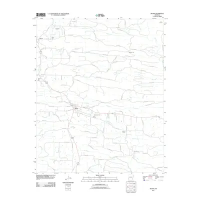
2011 Map of Wickes
USGS Topo · Published 2011About this map
The town of Wickes serves as the central hub of this South Arkansas landscape, where the local economy and road network follow the winding paths of numerous creek branches. Small-scale water management is evident through features like Jenkins Lake Dam and Brewer Lake Dam, which dot the drainages of Rolling Fork and Cow Creek. The topography is defined by significant ridges and passages, most notably Bradley Gap to the northeast, which historically influenced the movement of people and commerce through this part of Polk County.
Find a feature on this map
93 named features on this map. Tap any name to fly to it.
Don’t see what you’re looking for? This feature index may not catch every label — zoom into the map to look around manually.
Map Details
Editions of this 2011 Wickes Map
This is the sole edition of this map. No revisions or reprints were ever made.
Other maps of this area

1913 · De Queen
USGS Topo · 1:125,000

1950 · Mcalester
USGS Topo · 1:250,000

1959 · Umpire
USGS Topo · 1:62,500

1959 · Cove
USGS Topo · 1:62,500

1962 · McAlester
USGS Topo · 1:250,000

1964 · Gillham Dam
USGS Topo · 1:24,000

1964 · Gillham
USGS Topo · 1:24,000

1965 · McAlester
USGS Topo · 1:250,000
1966 · De Queen NW
USGS Topo · 1:24,000
1984 · Vandervoort
USGS Topo · 1:24,000