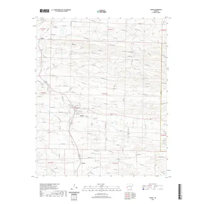
2020 Map of Wickes
USGS Topo · Published 2020About this map
Wickes serves as a central hub in this corner of Polk County, where the Kansas City Southern railroad line dictates the layout of regional transport. The terrain is defined by the high elevations of the Cross Mountains and the passage through Bradley Gap, with numerous watercourses like Rolling Fork and Opossum Cr carving through the landscape. For genealogists, the map is a significant resource, pinpointing several established burial sites including Witherspoon Cem and Tate Cem in the north, as well as Daniel Cem and Crystal Hill Cem near the town center. The settlement patterns follow the rail corridor south through Grannis, while the rural outskirts toward the Howard County line remain characterized by a dense network of forest roads and small tributaries such as Allen Br and Pryor Cr.
Find a feature on this map
108 named features on this map. Tap any name to fly to it.
Don’t see what you’re looking for? This feature index may not catch every label — zoom into the map to look around manually.
Map Details
Editions of this 2020 Wickes Map
This is the sole edition of this map. No revisions or reprints were ever made.
Other maps of this area

1913 · De Queen
USGS Topo · 1:125,000

1950 · Mcalester
USGS Topo · 1:250,000

1959 · Umpire
USGS Topo · 1:62,500

1959 · Cove
USGS Topo · 1:62,500

1962 · McAlester
USGS Topo · 1:250,000

1964 · Gillham Dam
USGS Topo · 1:24,000

1964 · Gillham
USGS Topo · 1:24,000

1965 · McAlester
USGS Topo · 1:250,000
1966 · De Queen NW
USGS Topo · 1:24,000
1984 · Vandervoort
USGS Topo · 1:24,000