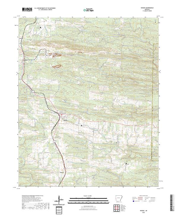
2024 Map of Wickes
USGS Topo · Published 2024About this map
Wickes and Grannis anchor the southern reaches of this landscape where the Ouachita foothills meet the coastal plain. The terrain is defined by the east-west ridges of the Cross Mountains, carved by drainages like Caney Creek, Cow Creek, and Opossum Creek. Local family history is preserved in several burial grounds scattered through the hills, including Witherspoon Cem and Daniel Cem. In the northeast corner, the Cossatot Wild and Scenic River forms a protected corridor near the Howard County line. The map reveals a dense network of timber and forest access roads, such as Polk Road 482 and Forest Rd, which wind through gaps like Bradley Gap to connect smaller settlements like Hatton with the larger transport corridor following the highway and rail lines through the center of the township.
Find a feature on this map
103 named features on this map. Tap any name to fly to it.
Don’t see what you’re looking for? This feature index may not catch every label — zoom into the map to look around manually.
Map Details
Editions of this 2024 Wickes Map
This is the sole edition of this map. No revisions or reprints were ever made.
Other maps of this area

1913 · De Queen
USGS Topo · 1:125,000

1950 · Mcalester
USGS Topo · 1:250,000

1959 · Umpire
USGS Topo · 1:62,500

1959 · Cove
USGS Topo · 1:62,500

1962 · McAlester
USGS Topo · 1:250,000

1964 · Gillham Dam
USGS Topo · 1:24,000

1964 · Gillham
USGS Topo · 1:24,000

1965 · McAlester
USGS Topo · 1:250,000
1966 · De Queen NW
USGS Topo · 1:24,000
1984 · Vandervoort
USGS Topo · 1:24,000