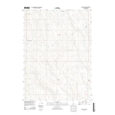
2013 Map of Wickiup Creek
USGS Topo · Published 2013About this map
Josephine Ranch Airport serves as a lone modern landmark in this high-desert reach of Owyhee County, where the landscape is defined by a dense network of seasonal drainages. Water sources like Long Valley Spring and Rose Creek Spring provide critical points of interest in a terrain marked by prominent elevations such as Rose Ridge and Combination Ridge.
Find a feature on this map
18 named features on this map. Tap any name to fly to it.
Don’t see what you’re looking for? This feature index may not catch every label — zoom into the map to look around manually.
Map Details
Editions of this 2013 Wickiup Creek Map
This is the sole edition of this map. No revisions or reprints were ever made.
Other maps of this area

1955 · Jordan Valley
USGS Topo · 1:250,000

1957 · Jordan Valley
USGS Topo · 1:250,000

1958 · Jordan Valley
USGS Topo · 1:250,000

1965 · Triangle
USGS Topo · 1:62,500

1965 · Flint Creek
USGS Topo · 1:62,500
1973 · Wagon Box Basin
USGS Topo · 1:24,000

1973 · Indian Meadows
USGS Topo · 1:24,000

1973 · Hurry Up Creek
USGS Topo · 1:24,000

1973 · Pleasant Valley
USGS Topo · 1:24,000

1973 · Wickiup Creek
USGS Topo · 1:24,000