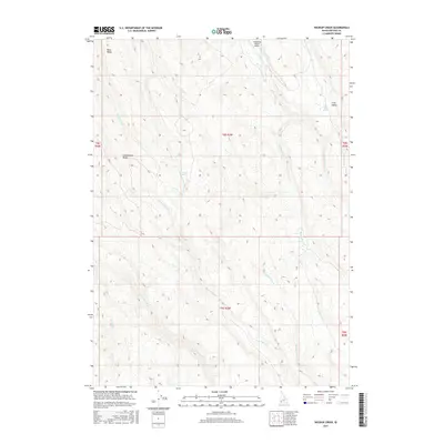
2017 Map of Wickiup Creek
USGS Topo · Published 2017About this map
Josephine Ranch Airport provides a rare point of human infrastructure in this expansive reach of Owyhee County, situated among the drainages that feed the region's complex creek network. The terrain is defined by prominent high points such as Rose Ridge and Combination Ridge, which separate various water systems including Rose Cr and Combination Cr. Evidence of the area's hydrology is found at Rose Creek Spring and Long Valley Spring, suggesting vital water sources for local ranching and wildlife in an otherwise arid landscape. This 2017 survey details the intricate drainage patterns of Anne Valley Cr and Wickiup Creek, showing how the land is segmented into various townships and ranges, including t8s r3w and t9s r3w, reflecting the enduring legal framework of the Public Land Survey System in the high desert.
Find a feature on this map
21 named features on this map. Tap any name to fly to it.
Don’t see what you’re looking for? This feature index may not catch every label — zoom into the map to look around manually.
Map Details
Editions of this 2017 Wickiup Creek Map
This is the sole edition of this map. No revisions or reprints were ever made.
Other maps of this area

1955 · Jordan Valley
USGS Topo · 1:250,000

1957 · Jordan Valley
USGS Topo · 1:250,000

1958 · Jordan Valley
USGS Topo · 1:250,000

1965 · Triangle
USGS Topo · 1:62,500

1965 · Flint Creek
USGS Topo · 1:62,500
1973 · Wagon Box Basin
USGS Topo · 1:24,000

1973 · Indian Meadows
USGS Topo · 1:24,000

1973 · Hurry Up Creek
USGS Topo · 1:24,000

1973 · Pleasant Valley
USGS Topo · 1:24,000

1973 · Wickiup Creek
USGS Topo · 1:24,000