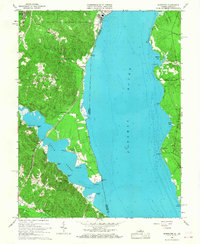
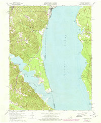
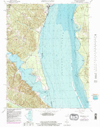
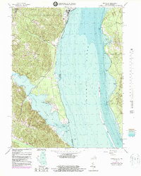
1966 Map of Widewater
USGS Topo · Published 1968About this map
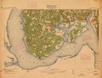
The Potomac River dominates this mid-1960s survey, separating the wooded heights of Stafford County from the Maryland shore at Mallows Bay. Along the Virginia side, the Richmond Fredericksburg and Potomac railroad corridor dictates the placement of small communities like Arkendale and Widewater. This stretch of the river is defined by its dramatic points and inlets, where the deep waters of Aquia Creek meet the Potomac. Inland, the landscape retains its rural character, marked by essential local landmarks such as Mountjoy Store, Decatur Store, and Clifton Chapel.
Find a feature on this map
46 named features on this map. Tap any name to fly to it.
Don’t see what you’re looking for? This feature index may not catch every label — zoom into the map to look around manually.
Map Details
Editions of this 1966 Widewater Map
5 editions found

Other maps of this area

1889 · Fredericksburg
USGS Topo · 1:125,000

1890 · Mt. Vernon
USGS Topo · 1:125,000

1891 · Mt. Vernon
USGS Topo · 1:125,000

1892 · Fredericksburg
USGS Topo · 1:125,000

1894 · Fredericksburg
USGS Topo · 1:125,000

1894 · Mt. Vernon
USGS Topo · 1:125,000

1897 · Mt. Vernon
USGS Topo · 1:125,000

1913 · Indian Head
USGS Topo · 1:62,500
1913 · Nanjemoy
USGS Topo · 1:62,500

1923 · Indian Head
USGS Topo · 1:48,000