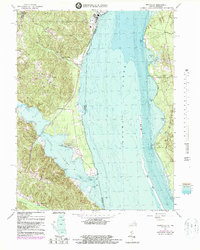
1966 Map of Widewater
USGS Topo · Published 1987About this map
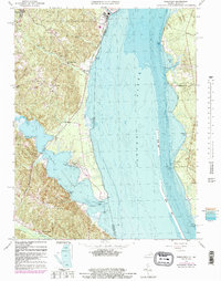
Quantico Marine Corps Schools dominates the northwestern landscape of this survey, illustrating the significant military footprint along the Virginia shoreline during the mid-to-late 20th century. The Richmond Fredericksburg and Potomac railroad serves as the primary terrestrial artery, paralleling the river and connecting small stops and communities like Arkendale and Widewater. This map is particularly valuable for its bathymetric data added in the early 1980s, revealing the underwater contours of the Potomac River and its major inlets at Aquia Creek and Mallows Bay. Land use is a mix of military training grounds and small coastal settlements, including uniquely named points such as Youbedamn Landing and Brent Pt. From the Marine Corps Air Station in the north to the wetlands of Brent Marsh in the south, the map captures a period of transition where maritime tradition met modern military infrastructure.
Find a feature on this map
42 named features on this map. Tap any name to fly to it.
Don’t see what you’re looking for? This feature index may not catch every label — zoom into the map to look around manually.
Map Details
Editions of this 1966 Widewater Map
5 editions found
Other maps of this area

1889 · Fredericksburg
USGS Topo · 1:125,000

1890 · Mt. Vernon
USGS Topo · 1:125,000

1891 · Mt. Vernon
USGS Topo · 1:125,000

1892 · Fredericksburg
USGS Topo · 1:125,000

1894 · Fredericksburg
USGS Topo · 1:125,000

1894 · Mt. Vernon
USGS Topo · 1:125,000

1897 · Mt. Vernon
USGS Topo · 1:125,000

1913 · Indian Head
USGS Topo · 1:62,500

1913 · Nanjemoy
USGS Topo · 1:62,500

1923 · Indian Head
USGS Topo · 1:48,000