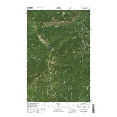
2017 Map of Widow Mountain
USGS Topo · Published 2017About this map
The high peaks and forest drainages of the St. Joe National Forest define this 2017 survey of the Idaho backcountry. Centered on Widow Mountain, the terrain is characterized by steep ridges and high-elevation basins such as Crater Lake and Fish Lake. A notable industrial artifact remains at the Splash Dam on Delaney Creek, a reminder of historical logging methods used to transport timber downstream. The map documents an extensive network of access routes, from established forest roads like the Outlaw Creek Road to remote paths including the Lookout Mountain Trail #52 and the Flatiron Stinger OHV route. High meadows such as Forty-nine Meadows and Fortune Meadows sit near the eastern boundary, while landmarks like Orphan Point and Long Hike Peak provide orientation across the complex drainage systems of the Little North Fork Clearwater River.
Find a feature on this map
52 named features on this map. Tap any name to fly to it.
Don’t see what you’re looking for? This feature index may not catch every label — zoom into the map to look around manually.
Map Details
Editions of this 2017 Widow Mountain Map
This is the sole edition of this map. No revisions or reprints were ever made.
Other maps of this area

1914 · Avery
USGS Topo · 1:125,000

1917 · Avery
USGS Topo · 1:125,000

1923 · Washington Creek
USGS Topo · 1:125,000

1936 · Boehls Butte
USGS Topo · 1:48,000

1943 · Boehls Butte
USGS Topo · 1:62,500

1955 · Pullman
USGS Topo · 1:250,000

1955 · Spokane
USGS Topo · 1:250,000

1956 · Wallace
USGS Topo · 1:250,000

1956 · Hamilton
USGS Topo · 1:250,000

1958 · Spokane
USGS Topo · 1:250,000