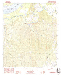
1986 Map of Widows Creek
USGS Topo · Published 1986About this map
Bayou Pierre meanders through the heart of this landscape, a complex drainage system defining the border between Tensas Parish and Claiborne County as it approaches the Mississippi River. The terrain is characterized by intricate oxbow features and wetlands, such as Coon Island Lake and Lily Pond, indicating a dynamic floodplain history. Small inland settlements like Russum and Centers anchor the southern and eastern portions of the map, connected by the historically significant route of the Natchez Trace Parkway.
Find a feature on this map
16 named features on this map. Tap any name to fly to it.
Don’t see what you’re looking for? This feature index may not catch every label — zoom into the map to look around manually.
Map Details
Editions of this 1986 Widows Creek Map
This is the sole edition of this map. No revisions or reprints were ever made.
Other maps of this area

1909 · Lake Bruen
USGS Topo · 1:24,000

1939 · Yokena
USGS Topo · 1:62,500

1939 · Lorman
USGS Topo · 1:62,500

1953 · Natchez
USGS Topo · 1:250,000

1955 · Jackson
USGS Topo · 1:250,000

1956 · Natchez
USGS Topo · 1:250,000

1958 · St. Joseph
USGS Topo · 1:62,500

1959 · Natchez
USGS Topo · 1:250,000

1961 · Jackson
USGS Topo · 1:250,000

1962 · Jackson
USGS Topo · 1:250,000