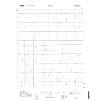
2018 Map of Wiest
USGS Topo · Published 2018About this map
The settlement of Wiest and the nearby siding of Munyon anchor this 2018 portrait of the Imperial Valley agricultural landscape. The map reveals an intricate, grid-based plumbing system that transformed this arid region, featuring a dense network of named water-control structures such as the Vail Supply Canal, Nectarine Lateral, and Marigold Lateral. These channels feed the surrounding fields, punctuated by natural and semi-natural water bodies like Finney Lake and Wiest Lake. The winding Alamo River cuts a distinct, irregular path through the otherwise rigid geometry of section lines and irrigation dikes. Local roads, often named for the families who farmed this land—including Chalupnik Rd, Dickerman Rd, and Phegley Rd—provide a clear record of the area's rural development and property division in the early 21st century.
Find a feature on this map
86 named features on this map. Tap any name to fly to it.
Don’t see what you’re looking for? This feature index may not catch every label — zoom into the map to look around manually.
Map Details
Editions of this 2018 Wiest Map
This is the sole edition of this map. No revisions or reprints were ever made.
Other maps of this area

1907 · Holtville
USGS Topo · 1:125,000

1915 · El Centro
USGS Topo · 1:125,000

1940 · Brawley
USGS Topo · 1:62,500

1940 · Iris
USGS Topo · 1:62,500

1940 · Alamorio
USGS Topo · 1:62,500

1942 · El Centro
USGS Topo · 1:250,000

1943 · Brawley
USGS Topo · 1:62,500

1944 · Calipatria
USGS Topo · 1:62,500

1945 · Alamorio
USGS Topo · 1:62,500

1945 · Iris
USGS Topo · 1:62,500