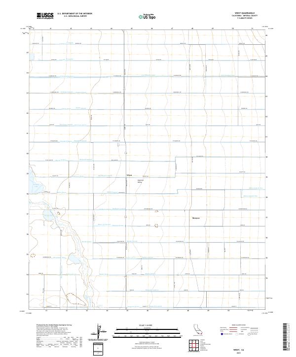
2021 Map of Wiest
USGS Topo · Published 2021About this map
Imperial Valley agriculture is defined by the intricate network of irrigation ditches and drains that cross this section of Imperial County. The landscape is a testament to hydraulic engineering, featuring a vast grid of named watercourses such as the Vail Supply Canal, Marigold Lateral, and Nutmeg Lateral. These man-made channels support the intensive farming around the settlements of Wiest and Munyon, where the dry desert has been transformed into a productive agricultural basin. Near the southern end of the sheet, the Alamo River meanders toward Wiest Lake and Finney Lake, providing rare natural breaks in the rigid geometry of the canal system. Local history is etched into the road grid, with many routes like Chalupnik RD and Dickerman RD likely named for the pioneering farming families who settled these tracts.
Find a feature on this map
87 named features on this map. Tap any name to fly to it.
Don’t see what you’re looking for? This feature index may not catch every label — zoom into the map to look around manually.
Map Details
Editions of this 2021 Wiest Map
This is the sole edition of this map. No revisions or reprints were ever made.
Other maps of this area

1907 · Holtville
USGS Topo · 1:125,000

1915 · El Centro
USGS Topo · 1:125,000

1940 · Brawley
USGS Topo · 1:62,500

1940 · Iris
USGS Topo · 1:62,500

1940 · Alamorio
USGS Topo · 1:62,500

1942 · El Centro
USGS Topo · 1:250,000

1943 · Brawley
USGS Topo · 1:62,500

1944 · Calipatria
USGS Topo · 1:62,500

1945 · Alamorio
USGS Topo · 1:62,500

1945 · Iris
USGS Topo · 1:62,500